
4 Survey Drones |
|


Our Aerial Surveying team is fully certified and trained with experience and qualifications that will ensure the effective management of your project from start to finish
GPS Surveying equipment
Autocad Civil 3D
Pix 4D
Flight ground school
U.A.V (Unmanned Aerial Vehicle) Training
Aeronautical radio license
G.I.S (Geographical Information Systems)
Autocad Civil 3D
Pix 4D
Flight ground school
U.A.V (Unmanned Aerial Vehicle) Training
Aeronautical radio license
G.I.S (Geographical Information Systems)
Aerial Survey Drones are revolutionizing surveying and mapping by offering an accurate, flexible data collection solution. It dramatically cuts costs and significantly increases safety and eliminates risks.
What took days with old survey methods now takes hours at a fraction of the cost. Aerial Drones offer a consistent, reliable and affordable means for companies to collect and report data in user-friendly formats to make decisions faster than ever.
What took days with old survey methods now takes hours at a fraction of the cost. Aerial Drones offer a consistent, reliable and affordable means for companies to collect and report data in user-friendly formats to make decisions faster than ever.
Aerial Drone Surveying Will:

Eliminate Risk |
Maximize Safety |

Not Interfere with Environment |
Our Equipment
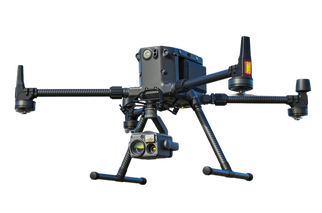
Matrice 300 RTK- 6 directional sensing & positioning
- 15KM Transmission - Works well in extreme temperatures |
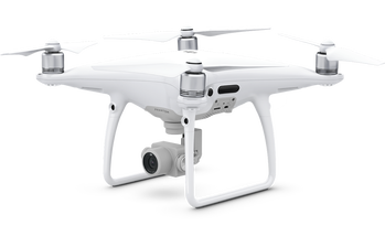
Phantom 4 Pro- Provides high-resolution still photos and 4K HD video
- Great for flying in tight, obstructed areas - Smaller volumetric and sight surveys |
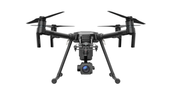
M200 Quadcopter- Long run times and very stable flying platform for high winds and poor weather
- Can capture thermal imagery - Useful for many applications |
Certified